|
Other files which are related to, or may be required by, this file:
Images related to this file:
|
File Description:
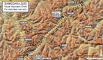
Custom made visual approach chart and pilot's briefing for Engadin (St. Moritz) Samedan LSZS airport in Switzerland, Europe's highest elevation airport (5,600 ft.) situated in the Swiss Alps. This airport is a day VFR operations only and has no instrument approach due to extreme terrain around it. A demanding visual descent into a canyon, in between steep rising terrain, is required to make the visual approaches for both runways with a steep 4.4* degrees final approach portion guided by the PAPI's. Still, executive jets up to Boeing 737(BBJ) size approach the airport often in the winter peak season VFR with these procedures. It is designed as per real operators' pilot briefing for Samedan. Real airport's full pilot briefing document also included. The real airport's excellent briefing (included) intentionally does not contain the maneuvers needed for the approach of jets through the mountains but only reporting points for all and maneuvers for light aircraft only. This gap is what this chart covers. Version 2 chart included better graphics and refined visual procedure for jets and version 3 now includes real pilot's briefing guide.
|
| Filename: |
lszs_visual_chart_v3.zip |
| License: |
Freeware, limited distribution |
| Added: |
20th March 2015, 23:35:11 |
| Downloads: |
1969 |
| Author: |
Kyprianos Biris |
| Size: |
7271kb |
|


