|
AVSIM Library - Search Results
|
|
Login | Register | About logging in and out
|
Searching for:
Author matching 'Holger Sandmann'
in AVSIM File Library and below.
|

|
|
|
|
|
|
File Description:
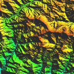
Highly detailed terrain mesh of the Namcha Barwa area, N29°-31° E94°-96°. The files in this package are based on Shuttle Radar (SRTM) Version 2 data but with many of the void areas, especially the most significant sections, filled with elevation data generated from topographic maps by Jonathan de Ferranti. While Jonathan's work is unrelated to flight simulation he kindly gave me permission to compile his data for use in FS. The result is a wonderful improvement in detail and accuracy over any existing mesh file, freeware or commercial, based on SRTM or DTED data alone. Due to the large area of the Himalayas I've compiled the source data as two separate series: the "Himalayan Peaks" series covers prominent mountains and ranges in higher detail and locally overrides any existing LOD9 terrain mesh. In addition, a LOD9 "base mesh" series covering the entire Himalayas will be available for those who do not yet have an add-on terrain mesh of these beautiful mountains.
| Filename: |
fs_him_03.zip |
| License: |
Freeware, limited distribution |
| Added: |
18th February 2006, 23:15:17 |
| Downloads: |
12159 |
| Author: |
Holger Sandmann and Jonathan de Ferranti |
| Size: |
15451kb |
|
|

|
File Description:
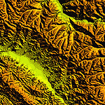
Highly detailed terrain mesh of the Annapurna area, N28-30 E83-85. The files in this package are based on Shuttle Radar (SRTM) Version 2 data but with many of the void areas, especially the most significant sections, filled with elevation data generated from topographic maps by Jonathan de Ferranti. While Jonathan's work is unrelated to flight simulation he kindly gave me permission to compile his data for use in FS. The result is a wonderful improvement in detail and accuracy over any existing mesh file, freeware or commercial, based on SRTM or DTED data alone.
Due to the large area of the Himalayas I've compiled the source data as two separate series: the "Himalayan Peaks" series covers prominent mountains and ranges in higher detail and locally overrides any existing LOD9 terrain mesh. In addition, a LOD9 "base mesh" series covering the entire Himalayas will be available for those who do not yet have an add-on terrain mesh of these beautiful mountains.
|
| Filename: |
fs_him_04.zip |
| License: |
Freeware, limited distribution |
| Added: |
29th May 2010, 08:59:29 |
| Downloads: |
10433 |
| Author: |
Holger Sandmann, Jonathan de Ferranti |
| Size: |
15427kb |
|
|
File Description:
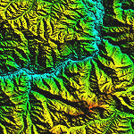
Highly detailed terrain mesh of the Garhwal area, N30°-32° E78°-81°. The files in this package are based on Shuttle Radar (SRTM) Version 2 data but with many of the void areas, especially the most significant sections, filled with elevation data generated from topographic maps by Jonathan de Ferranti. While Jonathan's work is unrelated to flight simulation he kindly gave me permission to compile his data for use in FS. The result is a wonderful improvement in detail and accuracy over any existing mesh file, freeware or commercial, based on SRTM or DTED data alone. Due to the large area of the Himalayas I've compiled the source data as two separate series: the "Himalayan Peaks" series covers prominent mountains and ranges in higher detail and locally overrides any existing LOD9 terrain mesh. In addition, a LOD9 "base mesh" series covering the entire Himalayas will be available for those who do not yet have an add-on terrain mesh of these beautiful mountains.
| Filename: |
fs_him_05.zip |
| License: |
Freeware, limited distribution |
| Added: |
18th February 2006, 23:16:47 |
| Downloads: |
10099 |
| Author: |
Holger Sandmann and Jonathan de Ferranti |
| Size: |
28382kb |
|
|

|
File Description:
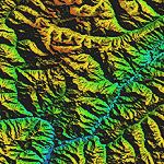
Highly detailed terrain mesh of the Jammu and Kashmir areas, N31-36 E76-78. The files in this package are based on Shuttle Radar (SRTM) Version 2 data but with many of the void areas, especially the most significant sections, filled with elevation data generated from topographic maps by Jonathan de Ferranti. While Jonathan's work is unrelated to flight simulation he kindly gave me permission to compile his data for use in FS. The result is a wonderful improvement in detail and accuracy over any existing mesh file, freeware or commercial, based on SRTM or DTED data alone.
Due to the large area of the Himalayas I've compiled the source data as two separate series: the "Himalayan Peaks" series covers prominent mountains and ranges in higher detail and locally overrides any existing LOD9 terrain mesh. In addition, a LOD9 "base mesh" series covering the entire Himalayas will be available for those who do not yet have an add-on terrain mesh of these beautiful mountains.
|
| Filename: |
fs_him_06.zip |
| License: |
Freeware, limited distribution |
| Added: |
29th May 2010, 08:55:43 |
| Downloads: |
9626 |
| Author: |
Holger Sandmann, Jonathan de Ferranti |
| Size: |
53444kb |
|
|

|
File Description:
Highly detailed terrain mesh of the Karakoram area, N35-37 E73-77. The files in this package are based on Shuttle Radar (SRTM) Version 2 data but with many of the void areas, especially the most significant sections, filled with elevation data generated from topographic maps by Jonathan de Ferranti. While Jonathan's work is unrelated to flight simulation he kindly gave me permission to compile his data for use in FS. The result is a wonderful improvement in detail and accuracy over any existing mesh file, freeware or commercial, based on SRTM or DTED data alone.
Due to the large area of the Himalayas I've compiled the source data as two separate series: the "Himalayan Peaks" series covers prominent mountains and ranges in higher detail and locally overrides any existing LOD9 terrain mesh. In addition, a LOD9 "base mesh" series covering the entire Himalayas will be available for those who do not yet have an add-on terrain mesh of these beautiful mountains.
|
| Filename: |
fs_him_07.zip |
| License: |
Freeware, limited distribution |
| Added: |
30th May 2010, 09:56:27 |
| Downloads: |
9442 |
| Author: |
Holger Sandmann, Jonathan de Ferranti |
| Size: |
39503kb |
|
|

|
File Description:
Highly detailed terrain mesh of the Tirich Mir and Pamir areas, N36-39 E71-74. The files in this package are based on Shuttle Radar (SRTM) Version 2 data but with many of the void areas, especially the most significant sections, filled with elevation data generated from topographic maps by Jonathan de Ferranti. While Jonathan's work is unrelated to flight simulation he kindly gave me permission to compile his data for use in FS. The result is a wonderful improvement in detail and accuracy over any existing mesh file, freeware or commercial, based on SRTM or DTED data alone.
Due to the large area of the Himalayas I've compiled the source data as two separate series: the "Himalayan Peaks" series covers prominent mountains and ranges in higher detail and locally overrides any existing LOD9 terrain mesh. In addition, a LOD9 "base mesh" series covering the entire Himalayas will be available for those who do not yet have an add-on terrain mesh of these beautiful mountains.
|
| Filename: |
fs_him_08.zip |
| License: |
Freeware, limited distribution |
| Added: |
29th May 2010, 08:52:47 |
| Downloads: |
9076 |
| Author: |
Holger Sandmann, Jonathan de Ferranti |
| Size: |
49093kb |
|
|
File Description:
First in a series of files for setting up helicopters and their repaints as AI aircraft. Let's get you started with the FS default Bell 206b Jet Ranger, including sample AFCAD "heliports" and flight plans for Manhattan, Hongkong, Berlin, and several locations in northwestern North America. Flight behavior is approximated (!) with custom flight models. Requires additional downloads (see documentation).
| Filename: |
aiheli_1.zip |
| License: |
Freeware, limited distribution |
| Added: |
5th June 2003, 23:52:08 |
| Downloads: |
2943 |
| Author: |
Holger Sandmann |
| Size: |
820kb |
|
|
File Description:
Second in a series of files for setting up helicopters and their repaints as AI aircraft. Set-up templates for five freeware GMax helicopters by European modelers: AS341 Gazelle, AS365 Dauphin, Eurocopter EC130, Bell 47 G2, and Westland Merlin. Includes sample AFCAD "heliports" and flight plans for London, Sydney, Paris, Helsinki, and Kuiu Island. Flight behavior is approximated (!) with custom flight models. Requires additional downloads (see documentation).
| Filename: |
aiheli_2.zip |
| License: |
Freeware, limited distribution |
| Added: |
5th June 2003, 23:53:44 |
| Downloads: |
3945 |
| Author: |
Holger Sandmann |
| Size: |
646kb |
|
|
File Description:
Third in a series of files for setting up helicopters and their repaints as AI aircraft. Set-up templates for four of Alan Devins' excellent freeware GMax choppers: AS361B Alouette 3, Bell 206L Long Ranger, Bell 222b, and the Airwolf. Includes sample "heliports" and flight plans for Rome, Belfast-Aldergrove, and Juneau. Flight behavior is approximated (!) with custom flight models. Requires additional downloads (see documentation).
| Filename: |
aiheli_3.zip |
| License: |
Freeware, limited distribution |
| Added: |
5th June 2003, 23:54:38 |
| Downloads: |
2196 |
| Author: |
Holger Sandmann |
| Size: |
352kb |
|
|
File Description:
Fourth in a series of files for setting up helicopters and their repaints as AI aircraft. Set-up templates for four popular freeware choppers: Hughes 500D, Robinson R22 Beta II, Schweizer 300C, and Erickson S64E Aircrane. Includes sample AFCAD "heliports" and flight plans for Hawaiian Islands-hopping and two locations in Alaska. Flight behavior is approximated (!) with custom flight models. Requires additional downloads (see documentation).
| Filename: |
aiheli_4.zip |
| License: |
Freeware, limited distribution |
| Added: |
5th June 2003, 23:55:12 |
| Downloads: |
2748 |
| Author: |
Holger Sandmann |
| Size: |
658kb |
|
  |


